Mapped from Space: How Cyclone Ditwah Transformed Sri Lanka's Landscape
Cyclonic Storm Ditwah has become one of Sri Lanka’s most severe hydro-meteorological disasters in recent decades, triggering widespread flooding, landslides and a large-scale humanitarian crisis. The storm made landfall on Sri Lanka’s eastern coast around 27–28 November 2025 and lingered over the island for several days, bringing extreme rainfall to all 25 districts.
According to government authorities and United Nations agencies, several hundred people have been killed and many more remain missing, with casualty figures still being revised as search and recovery operations continue. More than 1.5 million people are estimated to have been affected nationwide. Hundreds of thousands were displaced at the peak of the crisis and sheltered in temporary relief centres, while tens of thousands of homes were reported damaged or destroyed.
Ditwah originated as a low-pressure system over the southwest Bay of Bengal between 25 and 26 November before intensifying into a cyclonic storm by 27 November. While wind speeds were moderate by cyclonic standards, the storm’s slow forward movement proved critical. By remaining over Sri Lanka for several days, Ditwah produced prolonged and intense rainfall, with some areas recording more than 350 mm within a 24-hour period.
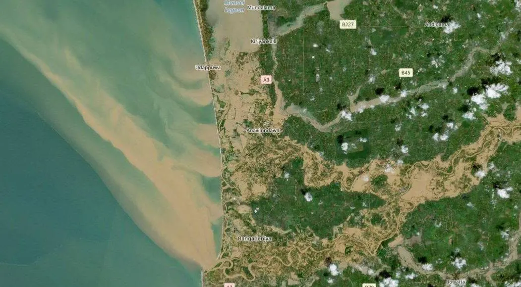
The storm’s impact was amplified by Sri Lanka’s geography. Heavy rainfall over the central and south-central highlands triggered widespread landslides across steep slopes, tea-estate regions and densely populated hillside settlements. At the same time, major rivers including the Kelani and Mahaweli overflowed their banks, causing extensive flooding in western and northwestern districts such as Colombo, Gampaha and Puttalam. Satellite imagery from the Copernicus Sentinel programme confirmed large-scale inundation of farmland, urban areas and key transport corridors.
Open-source intelligence assessments indicate a clear geographic divide in the nature of impacts. Highland districts including Kandy, Badulla, Nuwara Eliya, Matale and Kurunegala were primarily affected by landslides and slope failures. Kandy district alone reported dozens of fatalities and hundreds of landslide incidents by early December. In contrast, low-lying western and northern districts experienced severe riverine and urban flooding. Parts of the Colombo metropolitan area were submerged following the overflow of the Kelani River, leaving residents stranded until boat rescues could be carried out. Puttalam and surrounding areas also saw extensive agricultural and peri-urban flooding.
Puttalam District
Before and After
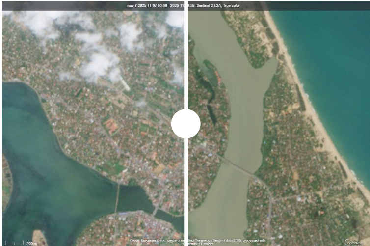
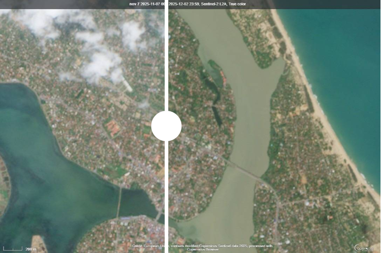
Batticaloa District
Before and After
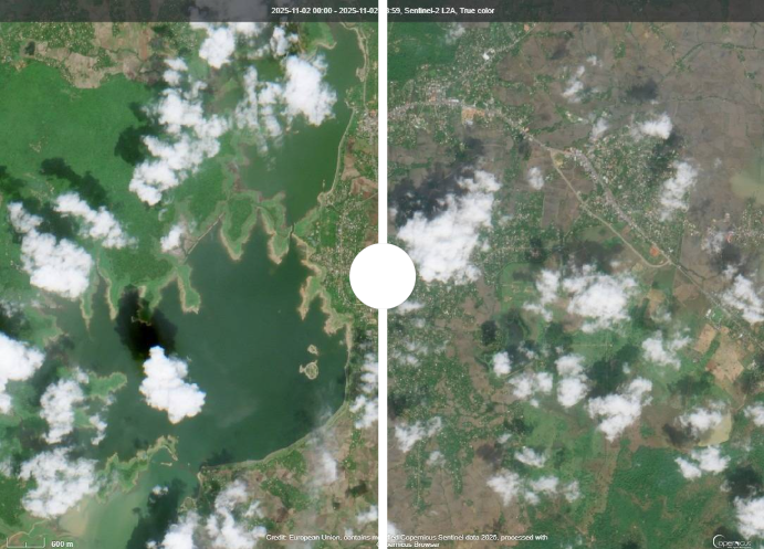
Polonnaruwa District
Before and After
International assistance played a significant role in the emergency response. India launched Operation Sagar Bandhu as one of the earliest humanitarian missions, deploying naval, air and disaster-response assets in coordination with Sri Lankan authorities. Indian Navy vessels delivered relief supplies, while Indian Air Force aircraft and helicopters supported rescue operations and delivered essential materials. National Disaster Response Force teams assisted with search and rescue efforts and evacuations in some of the worst-affected districts.
Cyclone Ditwah underscores a critical lesson for Sri Lanka. Even storms with relatively moderate winds can become catastrophic when combined with extreme rainfall, vulnerable terrain and high population exposure. Strengthening early-warning systems, resilient infrastructure, land-use planning and coordinated disaster-response mechanisms will be essential to reducing losses from future climate-driven disasters.